Lidar survey in cloudy conditions in Cameroon
A dynamic field of view feature was used to overcome the inability of Lidar laser beams to penetrate persistent cloud cover in this project in Cameroon. In Lidar surveys, minimizing...
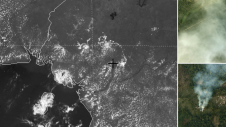
A dynamic field of view feature was used to overcome the inability of Lidar laser beams to penetrate persistent cloud cover in this project in Cameroon. In Lidar surveys, minimizing...

The role of aerial surveying in the technological response to challenges such as the global pandemic, climate change and societal issues was discussed at the EAASI Partners Summit in Malaga,...
Teledyne Optech and Teledyne CARIS have united to form Teledyne Geospatial in response to evolving marketplace needs. Under the Teledyne Imaging group, the harmony between the two business units is...
Teledyne Optech and Teledyne CARIS have united to form Teledyne Geospatial in response to the evolving marketplace needs. Under the Teledyne Imaging group, the harmony between the two business units...
Teledyne has announced the launch of a geospatial group with the unification of its Optech and CARIS businesses. The new Teledyne Geospatial group will offer holistic solutions to seamlessly map...
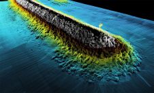
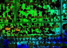
Lidar technology is synonymous with 3D point clouds. To get the most out of 3D point cloud data, it is necessary to step back and continually consider the newest trends...
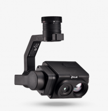
Teledyne Technologies Incorporated will acquire FLIR Systems in a cash and stock transaction valued at approximately US$8 billion. Under the terms of the agreement, FLIR stockholders will receive US$28.00 per...
Teledyne Optech is launching a new customer service centre dedicated to the service of equipment for its European clients. Teledyne Optech is a Teledyne Technologies company and a leader in...
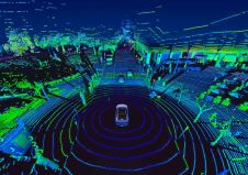
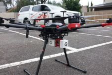
Various multibeam Lidar sensors are suited for mobile mapping. Read this article to learn more about their features and productivity. In mobile mapping, geospatial data is acquired by one or...
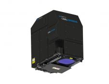
Teledyne Optech, the Canada-based advanced Lidar sensors company, has extended its Galaxy line-up to include the CM2000, a new sensor specifically designed for corridor mapping. With a true measuring rate...
This site uses cookies. By continuing to use this website, you agree to our Cookies Policy. Agree