Oblique Aerial Photography Archive of European Cities
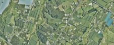
Thanks to a partnership with Blom UK, Bluesky International is now able to offer BlomOBLIQUE aerial images of hundreds of European cities, and more are being added to the online...
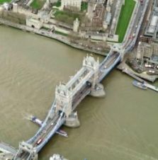
Thanks to a partnership with Blom UK, Bluesky International is now able to offer BlomOBLIQUE aerial images of hundreds of European cities, and more are being added to the online...
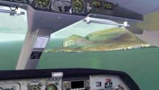
Getmapping’s aerial photographic survey of Scotland is being compiled into a comprehensive set of terrain scenery by Horizon Simulation for the popular Microsoft Flight Simulator, ‘Generation X’ edition. The first...
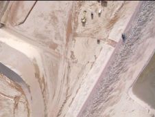
Kragten has fulfilled a trial with the X100 of Gatewing, an Unmanned Aerial Vehicle (AUV), equipped with a camera. The airplane as mapped an area of 1,200 x 1,400m with...
Following an agreement between aerial survey specialist Bluesky and Getmapping the original images that make up the Millennium Map will now be available from www.oldaerialphotos.com. Billed at the time as...
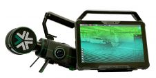
Exyn Technologies has unveiled Exyn Nexys, an innovative modular 3D mapping solution. Designed for professionals in the mining, construction, AEC and geospatial industries, Nexys aims to set a new standard...

RIEGL has announced the launch of two innovative topobathymetric scanners. These advancements mark a shift towards enhanced efficiency and precision in data collection across land and water interfaces. The RIEGL...
Land Information New Zealand has made 20TB of aerial imagery available for free for the first time in a cloud-optimized format on Amazon Web Services (AWS), making it easier and...

The EAASI Summit 2023 in Lisbon in November was a resounding success. While the aerial surveying association’s fifth annual gathering highlighted the growing unity within the industry, there was also...

The aerial survey system for upgrading digital maps of Qatar has become operational. Under the aerial surveys project for Qatar, the mission of aerial photography covering all parts of the...
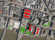
Bluesky International has supplied its high-resolution photography to support a new AI platform to map green infrastructure, aimed at identifying where biodiversity can increase in UK cities. The platform has...
This site uses cookies. By continuing to use this website, you agree to our Cookies Policy. Agree