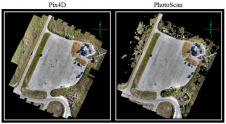
Producing High-quality 3D Point Clouds from Structure-from-Motion Photogrammetry
Anyone involved with structure-from-motion (SfM) photogrammetry has probably questioned which type of processing software is necessary for them to produce quality 3D point cloud data. Many SfM software packages exist...