Web-based 3D in Urban Planning
Urban planning has become more complicated due to today’s rate of urbanisation and the rapid expansion of cities. Web-based 3D tools coupled with high-quality 3D city models and digital terrain...
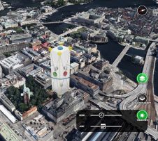
Urban planning has become more complicated due to today’s rate of urbanisation and the rapid expansion of cities. Web-based 3D tools coupled with high-quality 3D city models and digital terrain...

Topcon Positioning Group has entered into a new partnership with digital photogrammetric solution provider Agisoft. The aim of the agreement is to further expand the Topcon solutions portfolio for mass...

Photogrammetry and terrestrial laser scanning (TLS) are both proven technologies for archaeological documentation. Dense image matching (DIM) has evolved rapidly since 2010 and enables the highly automatic creation of detailed...
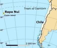
Unmanned aerial systems (UASs) can be easily transported and this beneficial feature is ideal for photogrammetric surveys of remote spaces. Rapa Nui (Easter Island), the most isolated inhabited place on...
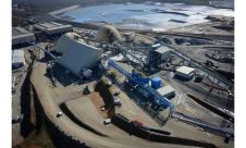
Knowing the volume of material present in a gravel quarry can make the difference between profit and loss. A gravel quarry in Hartheim am Rhein, southwest Germany, is partially covered...

In a recent project to obtain detailed and accurate orthoimages and 3D models to support technical staff in maintaining Prague Castle in the Czech Republic, the site was captured by...

Reconstruction and maintenance work in historical buildings such as churches requires detailed and accurate information about them, but it can be difficult and expensive to acquire such data efficiently. The...
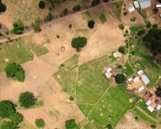
When conducting surveys in countries near the equator, environmental conditions can be harsh. Heat, dust and humidity may disrupt sensitive equipment, while distrustful locals may obstruct the undertaking. Read on...
When conducting surveys in countries near the equator, environmental conditions can be harsh. Heat, dust and humidity may disrupt sensitive equipment, while distrustful locals may obstruct the undertaking. Read on...
A growing number of mining companies are employing unmanned aerial vehicles (UAVs). Equipped with digital cameras, such remote-controlled small aircraft generate high-resolution aerial imagery which can be further processed to...
This site uses cookies. By continuing to use this website, you agree to our Cookies Policy. Agree