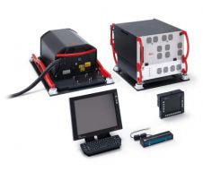
ProLogic Lidar Explorer 2.0 Webinar
Get an introduction to Lidar Explorer at one of ProLogic's free January webinars. The two webinars will be held Wednesday, January 9, 3:00 - 4:00 PM EST and Thursday, January...
Get an introduction to Lidar Explorer at one of ProLogic's free January webinars. The two webinars will be held Wednesday, January 9, 3:00 - 4:00 PM EST and Thursday, January...
YellowScan, a familiar name in the mapping and land surveying realm, is making a noteworthy entrance in the hydrographic sector with the introduction of its pioneering UAV-based bathymetric Lidar solution....
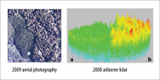
The traditional sampling protocol for quantifying potential nesting habitat for murrelet requires an observer to peer up through the tree crown from the forest floor, a task resulting in data...
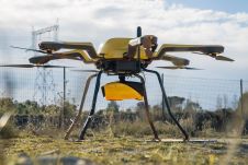
CHC Navigation (CHCNAV) has released the AlphaAir 1400 (AA1400) and AlphaAir 2400 (AA2400) Lidar systems. Both solutions are compact airborne laser scanners that are easily installed on various UAV platforms...

RIEGL has announced the launch of two innovative topobathymetric scanners. These advancements mark a shift towards enhanced efficiency and precision in data collection across land and water interfaces. The RIEGL...
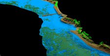
As part of a Catalan government project to improve the management of its marine environment, ICGC cooperated with Field to use airborne Lidar bathymetry (ALB) to survey the Catalan coastal...
The ALS70 family of airborne Lidar systems from Leica Geosystems includes the ALS70-CM City Mapper, ALS70-HP High Performance and ALS70-HA High Altitude models, covering the entire range of Lidar mapping...
Leica Geosystems' Point Density Multiplier technology for airborne Lidar allows the use of a single laser and scanning mechanism to provide over double the data collection productivity of previous systems....

Sven Cowan is NV5 Geospatial’s Programme Manager for Canada. He has over 20 years of experience in customer-facing positions within the geospatial information industry and has worked for multiple geospatial...
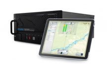
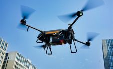
Teledyne Geospatial has released the Galaxy Onboard, a workflow-focused solution that enables airborne surveyors to deliver quality-controlled processed data in real time. With Galaxy Onboard, Teledyne Geospatial has lowered the...
This site uses cookies. By continuing to use this website, you agree to our Cookies Policy. Agree