Geospatial digital twins will make cities smarter
Thanks to the ability of digital twins to provide insights into the reality of present conditions and the impacts of future scenarios, they have the potential to revolutionize the planning...
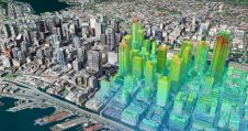
Thanks to the ability of digital twins to provide insights into the reality of present conditions and the impacts of future scenarios, they have the potential to revolutionize the planning...
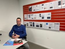
In this exclusive interview, two of the driving forces behind this year's Intergeo talk about the event's evolution and impact, nurturing talent, land surveying, Earth observation and the Blue Economy....

Planetek Italia has joined forces with Geosystems Middle East to support afforestation initiatives in Saudi Arabia through advanced Earth observation (EO) monitoring services. This marks a significant move for environmental...
Land Information New Zealand has made 20TB of aerial imagery available for free for the first time in a cloud-optimized format on Amazon Web Services (AWS), making it easier and...
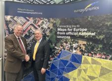
Geospatial data should be integrated into the next development framework to strengthen it and make it more inclusive beyond the 2030 Agenda, says EuroGeographics. The not-for-profit membership association for European...
Do you have an intriguing concept for an article in 'GIM International'? Our publication is continually seeking the most noteworthy developments and insights within the geomatics industry. Whether you are deeply...
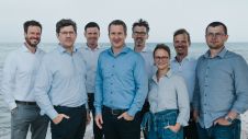
The merger of three Kiel-based software companies, north.io GmbH, TrueOcean GmbH and NatureConnect GmbH, marks a significant step forward in the use of digital technology for a sustainable future. These...
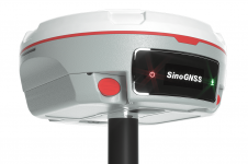
The Mars Pro Laser RTK is the third addition to ComNav’s Universe series of GNSS receivers, following on from the Venus Laser RTK and Mars Laser RTK. According to ComNav...
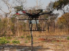
British mine-clearance charity The HALO Trust partnered with Routescene to undertake a UAV Lidar project in Cuito Cuanavale, in the Angolan province of Cuando Cubango. This case study demonstrates the...
Two expert organizations in authoritative geospatial data, cartography and GIScience have announced a new international collaboration to demonstrate the power of location. Members of EuroGeographics, the not-for-profit association for European...
This site uses cookies. By continuing to use this website, you agree to our Cookies Policy. Agree