Digital twins for a sustainable world
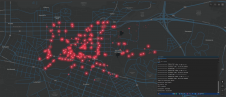
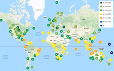
How can city digital twins support the attainment of SDG11? They can be used to manage infrastructures (e.g. roads, transportation and public services, smarter energy grids and water networks), support...
How can city digital twins support the attainment of SDG11? They can be used to manage infrastructures (e.g. roads, transportation and public services, smarter energy grids and water networks), support...
Woolpert has forged a strategic alliance with Allvision with the goal of enhancing geospatial artificial intelligence capabilities and applications. This partnership seamlessly integrates Pittsburgh-based geospatial analytics and asset management company...
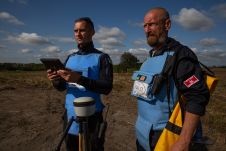
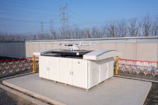
Trimble has announced a partnership with the HALO Trust, the world’s largest landmine-clearing non-profit organization, to help expand its demining operations across Ukraine. The grant from the Trimble Foundation Fund...
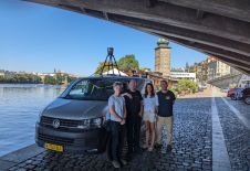
Prague recently served as the testing ground for the integration of Mosaic’s 360-degree camera system with SmartDelta’s mobile mapping software. Known for its rich history and stunning architecture, the city...
A global audience of geospatial professionals witnessed the presentation of the JOUAV VTOL Hangar, a groundbreaking development in the field of vertical take-off and landing (VTOL) drones, at Intergeo 2023....

Roshni Sharma has traversed environmental science and management, human geography, palaeoclimatology and business. She is now making it her life’s work to harness location intelligence to create tangible positive change...

Gravitational acceleration measurements were conducted in the Allgäu region of southern Germany by the Federal Agency for Cartography and Geodesy (BKG) in September this year. In high-altitude locations, helicopters were...
On 24 January 2023, the European Union declared the Galileo High Accuracy Service (HAS) operational for testing, and it is scheduled to become fully operational in 2024. This free signal adds...
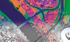
A pioneering project in Poland has proved that aerial mapping, combined with Lidar technology, can be an invaluable tool for accurately mapping the green urban environment. In fact, the new,...
In this exclusive interview, two of the driving forces behind this year's Intergeo talk about the event's evolution and impact, nurturing talent, land surveying, Earth observation and the Blue Economy....
This site uses cookies. By continuing to use this website, you agree to our Cookies Policy. Agree