Found 2609 results
Sort by

Oil Pollution Monitoring from Space

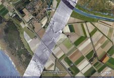
Between August and November 2009 as requested by Lukoil-Nizhnevolzhskneft, ScanEx Research and Development Center completed the project for satellite monitoring of oil pollution in the North Caspian region. The project...

Read more

Envisat Radar for Aircraft Monitoring

Entrepreneurs at ESA's Business Incubation centre in the Netherlands have used radar technology from the Envisat remote-sensing satellite to develop a compact, high-resolution radar that can monitor land and buildings...

Read more

Satellite-based Monitoring Caspian Sea

ScanEx Research and Development Center and the «Kazakh Agency of Applied Ecology» (KAPE) initiated the second stage of satellite-based radar monitoring of the northern and middle part of Caspian Sea....

Read more

Environmental Monitoring for Saudi Arabia

A group of Saudi Arabian and European partners has commenced a project to implement and provide satellite-based environmental information products and services to the Presidency of Meteorology and Environment (PME)...

Read more

Cosmic Science and Dam Monitoring

Advances in surveying technology continue to shape the way we understand our universe and monitor earth. Radio astronomy, key to disclosing the mysteries of the universe, is impossible without high-precision...

Read more

GPS for Land Subsidence Monitoring

Excessive groundwater extraction in the Bandung Basin has led to rapid sinking of the water table and is hypothesised as the main cause of land subsidence. Periodical GPS surveys were...

Read more

Leica GeoMoS Monitoring Software 2.1

With version 2.1 of GeoMoS, Leica Geosystems (Switzerland) has introduced several new possibilities for the users including enhanced update of TPS stand points and reference points by GPS, multiple graphs...

Read more