Marko Marković
Marko Marković is assistant professor at the Faculty of Technical Sciences (FTS), University of Novi Sad (UNS), Serbia. He received a PhD in geodesy from the FTS in 2018. His...

Marko Marković is assistant professor at the Faculty of Technical Sciences (FTS), University of Novi Sad (UNS), Serbia. He received a PhD in geodesy from the FTS in 2018. His...
Dr Andreas Georgopoulos is professor of photogrammetry in the School of Rural & Surveying Engineering (R&S Eng) at the National Technical University of Athens (NTUA) in Greece. He graduated from...
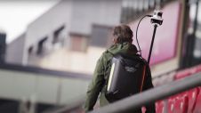
These inspiring articles all prove the versatility of the brilliant technology that is Lidar. Sensor miniaturization has made Lidar technology easier to integrate, enabling applications such as UAV-based and handheld...
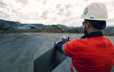
We’ve selected a number of articles providing an overview of the geospatial solutions used to solve challenges in the mining sector, ranging from infrastructure design to mapping & surveying the...

This issue puts aerial mapping centre stage. This issue puts aerial mapping centre stage. We zoom in on all the aspects that come into play when using state-of-the-art aerial remote sensing technology such as photogrammetry and Lidar...
This selection of articles highlights the diversity of Lidar as a flexible tool for surveying and mapping professionals. Thanks to sensor miniaturization, laser technology is available in many different guises...
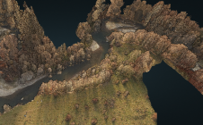
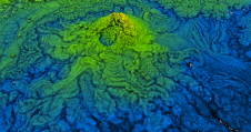
The monitoring of submerged deadwood and vegetation is gaining increased attention due to their socio-economic and ecological importance. Deadwood acts as an important underwater habitat but also poses a threat...
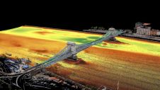
Two Hungarian companies designed a three-step data collection workflow to overcome the challenges in this urban surveying project in Hungary, which included the use of UAVs and remote-controlled boats for...
Dr Miklós Gross is an MSc engineer of photogrammetry, educated at the Moscow University of Engineers of Geodesy, Aerial Photography and Cartography, and honorary associate professor of GIS. He received...
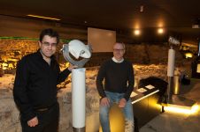
The Terra Mosana project is reinforcing the shared history in the territory where Germany, Belgium and the Netherlands meet. Today’s official country borders are relatively new, and geomatics can be...
This site uses cookies. By continuing to use this website, you agree to our Cookies Policy. Agree