
6 articles that prove Lidar’s versatility
These inspiring articles all prove the versatility of the brilliant technology that is Lidar. Sensor miniaturization has made Lidar technology easier to integrate, enabling applications such as UAV-based and handheld mapping. Now that compact Lidar systems are more readily available and affordable, a growing group of users can consider laser scanning as a mapping method for an increasing variety of applications.
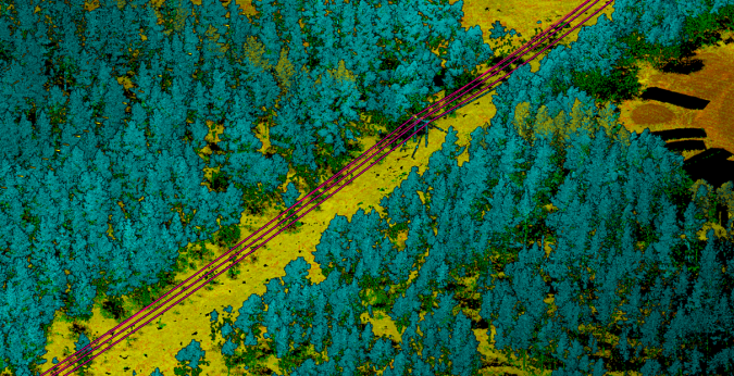
What are the main reasons for choosing UAV-based Lidar mapping?
Lidar mapping based on unmanned aerial vehicles (UAVs or ‘drones’) can generally be thought of as a close-range version of manned airborne laser scanning. In brief, lower mobilization costs and much higher spatial resolution are allowing new Lidar mapping use cases in several disciplines, such as forestry, bathymetry, archaeology, infrastructure mapping, hazard management and so on.
UAS mapping – where is it heading?
The key trend in the evolution of UAS mapping can be summarized as the miniaturization of components. Cameras and Lidar sensors suited for capturing high-quality data are becoming smaller and lighter, propped up by advanced processing software which facilitates the use of calibrated metric cameras and heavy Lidar sensors for precision solutions.
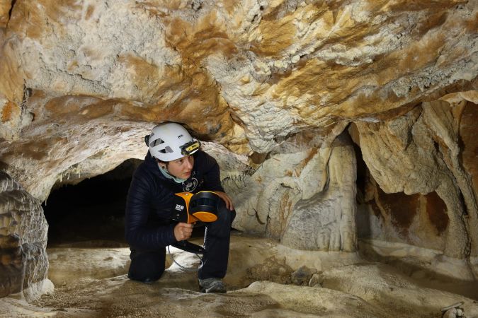
Handheld mapping of one of Europe’s largest caves
The Human Adaption Institute conducted a pioneering isolation experiment called ‘Deep Time’ in one of Europe’s largest cave systems: the 3km Lombrives cave. With low light levels, an ambient temperature of 10⁰C and 100% humidity levels, the physical and psychological impacts of the environment were monitored closely. The study was supported by geospatial mapping specialists and handheld Lidar scanners.
Creating a 3D model of the famous Budapest Chain Bridge
Two Hungarian companies designed a three-step data collection workflow to overcome the challenges in this urban surveying project, which included the use of UAVs and remote-controlled boats for Lidar and photogrammetry data. The result: a digital 3D BIM-compatible model of Budapest’s iconic bridge over the River Danube to assist in preparations for restoration and renovation work.
Read the story here
The age of mobile mapping
Looking back over the past 30 years, it’s hard to believe just how far we’ve come in such a relatively short space of time. With unprecedented absolute accuracy and an impeccable timing mechanism, GPS clearly offered a quantum leap in geomatics capabilities. Two decades later, Lidar – and in particular mobile terrestrial Lidar – seemed to represent the next quantum leap in geomatics technology since the advent of GPS.
Read the story here
Technologies for the future: a Lidar overview
Which technologies and processes are building the capability for high-density 3D data? Point clouds can be captured by an ever-increasing number of means to understand the surrounding reality and detect critical developments. Diverse applications of 3D laser scanning or Lidar, which is a technology on a sky-rocketing path to be used for mapping and surveying, are changing the way we collect and refine topographic data. This article outlines the latest industry developments.

Value staying current with geomatics?
Stay on the map with our expertly curated newsletters.
We provide educational insights, industry updates, and inspiring stories to help you learn, grow, and reach your full potential in your field. Don't miss out - subscribe today and ensure you're always informed, educated, and inspired.
Choose your newsletter(s)


