Zhen Dong
Prof Zhen Dong is currently a professor at the State Key Laboratory of Information Engineering in Surveying, Mapping, and Remote Sensing of Wuhan University. His research interest lies in the...
Prof Zhen Dong is currently a professor at the State Key Laboratory of Information Engineering in Surveying, Mapping, and Remote Sensing of Wuhan University. His research interest lies in the...

Yuzhou Zhou received an MSc degree in Photogrammetry and Remote Sensing from Wuhan University, China, in 2022. He is currently a DPhil student in the Department of Computer Science at...
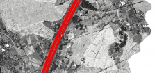
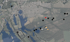
Thanks to rapid improvements in aerial laser scanning systems, they offer great potential in road surveying compared with traditional photogrammetry-based methods. Using the high-density 3D point clouds resulting from aerial...
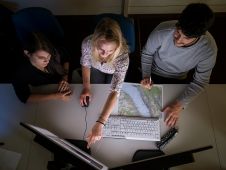
To find out more about the geomatics education situation across the globe, 'GIM International' spoke to several industry experts from academia around the world. Are the numbers of students in...
What are the primary technical differences between crewed and uncrewed aerial vehicles and satellites when it comes to capturing images of Earth? Where do they overlap, and where do they...
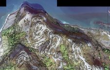
The International Association of Landscape Archaeology (IALA) has chosen a PhD thesis titled 'Learning to look at Lidar: combining CNN-based object detection and GIS for archaeological prospection in remotely-sensed data'...
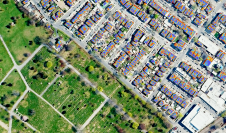
The UK's Environmental Protection Agency (EPA) and Tailte Éireann (formerly known as the Ordnance Survey of Ireland) have collaborated to launch a groundbreaking National Land Cover Map of Ireland. The...
Over the centuries, all four industrial revolutions have influenced surveying instruments and the profession as a whole. This article explores which different skills and capabilities surveyors are required to develop...

UP42, a geospatial developer platform and marketplace, has expanded its aerial imagery and elevation data portfolio through a partnership with Vexcel, a 30-year industry leader in photogrammetry and remote sensing....
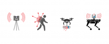
The Dutch startup Aerial Precision recently demonstrated its first two sensors with integrated artificial intelligence software. Over the past few years, the company’s innovation efforts have resulted in products that...
This site uses cookies. By continuing to use this website, you agree to our Cookies Policy. Agree