Digital twins for a sustainable world
How can city digital twins support the attainment of SDG11? They can be used to manage infrastructures (e.g. roads, transportation and public services, smarter energy grids and water networks), support...
How can city digital twins support the attainment of SDG11? They can be used to manage infrastructures (e.g. roads, transportation and public services, smarter energy grids and water networks), support...
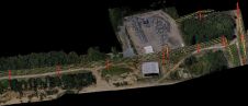
YellowScan, a France-based UAV-Lidar solutions provider, has released CloudStation. This new software provides a complete solution to create and manipulate point-cloud data. It allows users to extract, process and display...
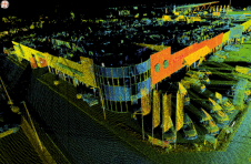
SimActive has announced the use of its Correlator3D product by Survtech Solutions for use in energy infrastructure mapping and monitoring. Using aerial imagery to colourize Lidar point clouds, a visual...
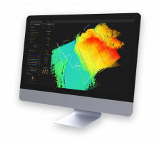
RIEGL has recently released its software suite for processing kinematic Lidar data: RiPROCESS 1.9.2. The software and the associated tools provide additional benefits for processing RIEGL kinematic laser scan data....

Unlicensed software, not to be confused with open source, has been costing the big players millions. Now, with the switch to the cloud, the pirates will be the ones getting...
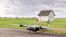
The new state-of-the-art Phase One P5 128MP camera has been seamlessly integrated into Quantum Systems’ flagship Trinity Pro mapping drone and the leading surveying workflow, Trimble Business Center. The resulting purpose-built,...

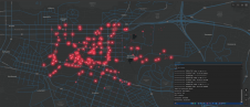
About us DECE Software was established in Ankara in 2014. We create innovative products on Big Data and Location Based Technologies. Our products GEODI and MOBIDI are the result of...
This site uses cookies. By continuing to use this website, you agree to our Cookies Policy. Agree