How digital twins add value in urban planning
As more and more cities are deciding to work with a digital twin, we have selected a number of articles that outline how digital twins are created and how they can add real value. Connecting and visualizing data – and especially geospatial data – in a digital replica of the public space supports urban policymaking and helps city planners to make effective and rational decisions to improve the quality of life.
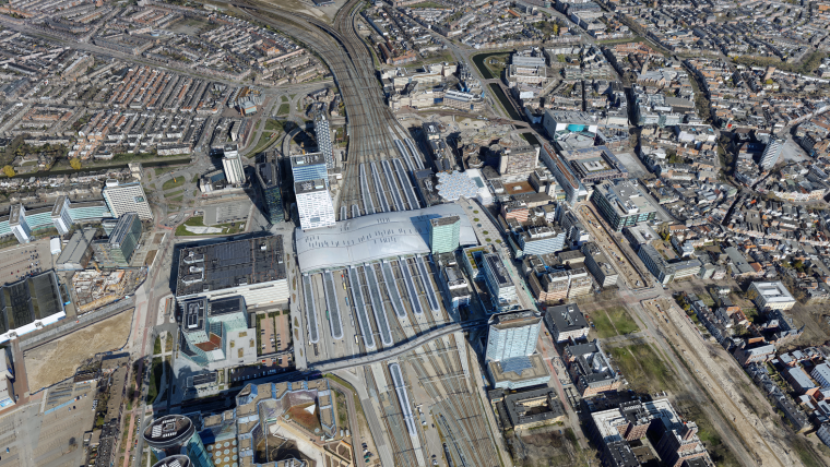
The Rotterdam 3D city model
If 3D is becoming the new normal in spatial data infrastructures, how can it be used in an urban environment? The Dutch city of Rotterdam, known as home to the largest port in Europe, is preparing for that next step by developing a digital twin of the physical city. The primary aim of ‘Digital City Rotterdam’ is to improve the efficiency of urban planning and management. But at the same time, the city council is on the lookout for applications that will help people integrate the digital world into their real one – or will it be the other way around in the not-so-distant future?
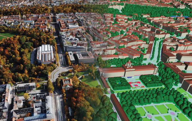
How 3D modelling supports game-changing urban development
Accurate digital representations of cities are game changers in urban development. By enabling virtual modelling and smart simulations, they allow decision-makers to explore, test and assess the measures taken. Hosted on cloud-enabled platforms, these digital twins also facilitate collaboration among stakeholders who can jointly optimize for outcomes that make cities smarter, safer, more livable and more sustainable.
Using BIM data together with city models
An increasing number of cities are creating 3D city models to support visualization and simulations in the urban planning process. The 3D city models are often extended with planned buildings. One way to facilitate this is to add simplified building information modelling (BIM) models of the planned buildings to the 3D city model. This article summarizes some of the recent academic and industrial studies of this topic.
Emerging web and game engine tech for 3D cities
The increasing number of solutions for developing 3D city model applications poses a challenge for developers. This article outlines key considerations that help them to create applications efficiently while utilizing the potential benefits of the 3D data.
Digital twins for spatial planning
The Dutch city of Groningen wants to follow in the footsteps of other cities such as Rotterdam, Hamburg, Singapore and Helsinki by developing a 3D digital model. For the team working on the 3D Digital City of Groningen project, the aim is for the image on the computer screen to be an identical replica of the reality outside.

Value staying current with geomatics?
Stay on the map with our expertly curated newsletters.
We provide educational insights, industry updates, and inspiring stories to help you learn, grow, and reach your full potential in your field. Don't miss out - subscribe today and ensure you're always informed, educated, and inspired.
Choose your newsletter(s)


