In land surveying the exact position and shape of objects on the surface of the earth is mapped. Included in the position is the height of an object. Techniques used are for example the total station, level instrument and GNSS. There is a direct relation between modern Remote Sensing techniques and land surveying and topography and often they are used side by side with land survey techniques providing highly accurate coordinates and remote sensing providing a broader overview. In traditional land surveying and topography objects are located in x,y and z with the addition of an object type. However, nowadays more and more attribute information is collected as well allowing detailed databases and products to be developed in cartography.

An important application for land surveying and topography is in construction and engineering but also in for example land and water management. Where land surveying and topography is about the visible objects on the earth surface, marine surveying and bathymetry is concerned with the objects under the water surface.

New mix of knowledge creates new competitive edge

New mix of knowledge creates new competitive edge

To find out more about the geomatics education situation across the globe, 'GIM International' spoke to several industry experts from academia around the world. Are the numbers of students in geomatic...

Key Global and Technology Drivers Impacting Surveying

Key Global and Technology Drivers Impacting Surveying

As the FIG commission chairs near the halfway point in their terms, they reflect on the global and technological drivers influencing their work. This article describes the breadth of work across the F...

Recent Advances in Geodata Acquisition Technologies

Recent Advances in Geodata Acquisition Technologies

Today’s geodata acquisition technologies combine microprocessors, computer power, solid state drives, complementary metal-oxide-semiconductor (CMOS) sensors, miniaturisation and many more developmen...

Bringing Reality into the Information Space

Bringing Reality into the Information Space

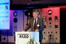
FARO is known as a trusted source of high-precision 3D measurement, imaging and visualisation technology. In the surveying and mapping field, the company is particularly well known for its laser scann...

Digital Aerial Cameras - Product Survey

This issue of GIM International provides an extensive product survey on digital aerial cameras. In support of the specifications provided by this product survey, this article presents additional infor...

Where do Geomatics Graduates Find Employment

Where do Geomatics Graduates Find Employment

Tom Bramald and Karen Allenby explore where Newcastle University’s geomatics graduates are finding employment and discuss what makes them employable. Although attracting school leavers to study geom...

Light Mobile Collection Tools for Land Administration

Light Mobile Collection Tools for Land Administration

There is an urgent need for the administration of property and land use rights worldwide as the basis for social and economic growth. Notwithstanding the enormous investments by governments and intern...

Should We Replace the Word 'Geomatics'?

Should We Replace the Word 'Geomatics'?

In response to the findings from a recent poll by the Geomatics Professional Group Board (GPGB) of RICS, Brian Coutts traces the evolution of the word 'geomatics' and argues that the time has come to ...

The Name Game – again

The Name Game – again

Brian Coutts traces the evolution of the title geomatics and argues that the time has come to consider a change. That geomatics word has reared its (ugly) head again. The Geomatics Professional Group ...

Spatial Data for Africa

Spatial Data for Africa

A love of mathematics set one of Africa's foremost geo-information specialists on a mission to drive the development of spatial-data infrastructure across the continent Partnership and communication l...

Land Administration Domain Model

Land Administration Domain Model

An international group of land administration professionals initiated the development of a data model that facilitates the quick and efficient set-up of land registrations. Just as social issues benef...

Geomatics Education in Croatia

During the past year the Faculty of Geodesy at the University of Zagreb has introduced fundamental reform of all its education programmes, undergraduate, graduate and postgraduate doctoral studies, an...

China’s Unlimited Demand for Geomatics Specialists

China’s Unlimited Demand for Geomatics Specialists

Having led the famous Wuhan University, home to the world's biggest geomatics faculty, from 2003 to 2008, professor Liu Jingnan is one of the most respected Chinese academics in geodesy and satellite ...