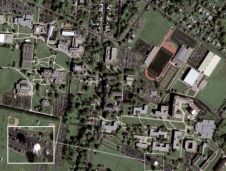
Found 399 results
Sort by

DiMAC Ultralight in North America

DIMAC Systems will unveil to North American customers during the Pecora ASPRS Remote Sensing Symposium 2008 of next week the DiMACULTRALiGHT, the smallest of the renowned DiMAC (Digital Modular Aerial...

Read more

Mapping with Digital Cameras

Over the period from December 2004 to 2008 the Institut Cartogràfic de Catalunya, Spain, took nearly 200,000 digital aerial images using two Digital Mapping Cameras (DMC) to replace analogue RC30...

Read more

3D Modeling of Acropolis

LPS was recently selected and utilised for a significant project to create 3D models of the Acropolis in Greece. LPS is an integrated suite of photogrammetry software tools for generating...

Read more

First 50cm Image Collected by GeoEye-1

AAMHatch is pleased to announce the release of the very first, 50cm resolution, colour image taken from the GeoEye-1 satellite. This image of an American University campus clearly portrays the...

Read more

SBG Systems

SBG Systems is a leading supplier of inertial motion sensing solutions, from miniature to high accuracy. Combined with cutting-edge calibration techniques and advanced embedded algorithms, SBG Systems’ products are ideal...

Read more

Presidential Inauguration from Space

GeoEye is offering for sale a commemorative poster featuring a GeoEye-1 satellite image of the Inauguration of President Barack Obama. The company had more than 100 times the normal traffic...

Read more

RapidEye Nearly Open for Business

RapidEye's satellite system has successfully completed all post-launch testing and calibration activities, and is now ready to take on commercial operations. The satellite constellation was successfully launched in August 2008....

Read more

Classroom Exercise

The mathematics a surveyor needs to calculate from measurement-derived quantities such as coordinates, distances, areas and volumes, are taught at length in secondary school, and most people will understand the...

Read more

EnsoMOSAIC UAV

The most new activity in remote sensing is at the moment found in the UAV and UAS sector (Unmanned Aerial Vehicle / System). There are hundreds of companies, institutions and...

Read more