Accurate footprints from Antarctica
Remote sensing surveys in Antarctica based on unmanned aerial vehicles (UAVs or ‘drones’) have become a very important approach for a wide range of studies. Mapping free-from-ice-and-snow terrain and monitoring...
Remote sensing surveys in Antarctica based on unmanned aerial vehicles (UAVs or ‘drones’) have become a very important approach for a wide range of studies. Mapping free-from-ice-and-snow terrain and monitoring...
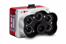
Topodrone, a Swiss-based designer and manufacturer of high-precision Lidar equipment for installation on drones, vehicles and backpacks, has launched Aquamapper, a UAV-based solution for bathymetric surveying and marine construction. The...
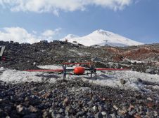
Mount Elbrus, with its peak of 5,642m, is the highest mountain in Europe. This makes it a remarkable attraction for adventurers, hikers and skiers from around the world, which calls...
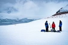
Capturing and measuring the environment in the Arctic and Antarctic is a particularly challenging job. The area of interest is often covered by a thick blanket of snow and ice,...

Is the market influx of cheap UAV hardware and software making it difficult for surveyors and engineers to produce quality mapping? Is the industry heading for a race to the...
Wingtra has launched its new MicaSense RedEdge Panchromatic (RE-P) payload. Capturing with the same five bands as the time-tested RedEdge-MX, the RE-P introduces a panchromatic sensor for enhanced resolution, life-like...
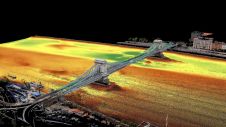
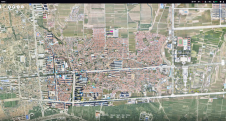
Two Hungarian companies designed a three-step data collection workflow to overcome the challenges in this urban surveying project in Hungary, which included the use of UAVs and remote-controlled boats for...

How accurate is accurate enough? If you’re like most land surveyors, the answer is “as much as possible.” With an RTK drone, surveyors and other drone pilots can expect centimetre-level...
Surveyors and GIS professionals have the highest standards when it comes to their tools and trade. It is therefore no wonder that many surveyors are turning to drones for their mapping and...

Following the devastating explosion of an ammonium stockpile in Beirut in August 2020, a UAV mapping project was rapidly initiated to assess the damage. The project was led by Augment,...
This site uses cookies. By continuing to use this website, you agree to our Cookies Policy. Agree