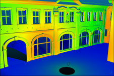
Representing 3D point cloud data
Read this guide to the main 3D data representation methods to understand the key differences and choose the best method for your specific applications. The 3D data jungle in today’s...

Read this guide to the main 3D data representation methods to understand the key differences and choose the best method for your specific applications. The 3D data jungle in today’s...
CHC Navigation is expanding its reach throughout Europe and the world, with more dealers and customer support and advanced training and service points. The Shanghai-based company has been a player in...
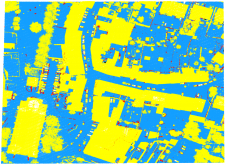
As a division of machine learning, deep learning (DL) has been achieving unparalleled success in image processing and recently demonstrated huge potential for point cloud analysis. Precise ground surface topography...
When it comes to monitoring the condition of roads, UAV technology can overcome many of the downsides associated with traditional methods, which can be time-consuming, labour-intensive and sometimes subjective. This...
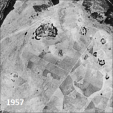
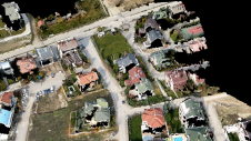
Only a small fraction of the information content in aerial films has ever been recorded on paper maps, most of which are inaccessible. The use of artificial intelligence (AI) to...

SSatellite surveying… are there any industry professionals out there not using it on (almost) a daily basis? In this issue of GIM International we highlight the recent developments in positioning and navigation systems and investigate how new solutions are set to bridge the gap between RTK and PPP. Additionally, we focus on the creation of a digital twin of Germany and on the development of a virtual terrestrial laser scanner simulator as a training tool to support the learning of laser scanning processes. Satellite surveying… are there any industry professionals out there not using it on (almost) a daily basis? In this issue of GIM International we highlight the recent developments in positioning...
The VRscan3D project has developed a virtual terrestrial laser scanner simulator as a training tool to support the learning of laser scanning processes. It is intended for use by universities...

Marcos Arza-García is a postdoctoral researcher with the CIGEO-Civil & Geomatics Research Group at the University of Santiago de Compostela (USC), Spain. His research interests include the use of spaceborne...
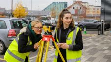
The coming years look promising for the geomatics sector, but the new generation of professionals must be prepared to face the challenges ahead. In view of the looming labour shortage...
Besides the surveying hardware & software and the intricacies of BIM and data exchange, this article explores broader aspects of digitalization in the construction industry. How are they affecting the...
This site uses cookies. By continuing to use this website, you agree to our Cookies Policy. Agree