Obituary: Fritz Ackermann
Sadly, Prof Dr Fritz Ackermann passed away at the age of 92 on 4 December 2021. He was a professor of photogrammetry and surveying at the University of Stuttgart in...

Sadly, Prof Dr Fritz Ackermann passed away at the age of 92 on 4 December 2021. He was a professor of photogrammetry and surveying at the University of Stuttgart in...
Trimble has introduced the latest version of its core geospatial automated monitoring software: Trimble 4D Control version 6.3. The software provides automated movement detection to enable informed decisions about infrastructure...
Trimble has introduced the R750 modular GNSS receiver, a connected base station for use in civil construction, geospatial and agricultural applications. The R750 provides improved base station performance, giving contractors,...
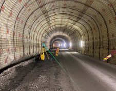
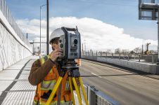
A Norwegian civil engineering construction company is using 3D scanning to survey two critical underwater road tunnels. Mesta AS has opted for a Trimble SX12 scanning total station to benefit...
In the wake of Hurricane Henri and Hurricane Ida, Applanix, a Trimble Company, and NOAA recently collaborated to provide critical information to first responders. Applanix’s high-accuracy direct georeferencing (DG) technology...

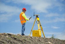
Geodesists and surveyors in Iceland face considerable challenges due to the deformation effects of earthquakes, volcanic eruptions and glaciers on the geodetic networks. This article provides insight into the impact...

Trimble and Microsoft have announced a strategic partnership to advance technology adoption and accelerate the digital transformation of the construction, agriculture and transportation industries. By leveraging the Microsoft cloud, Trimble...
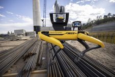
Trimble has released the X7 3D laser scanner and FieldLink software fully integrated with Boston Dynamics' Spot robot. This turnkey solution from Trimble, jointly developed with Boston Dynamics, facilitates autonomous...

The Capital District of Bogotá, Colombia, is using artificial intelligence to analyse images collected through terrestrial and aerial mapping. By identifying homes and neighbourhoods that need to be improved, the...

Take control of the way you work. Scanning, imaging, processing, and sharing at speed and scale. Trimble Mobile Mapping technology unlocks the next generation of geospatial projects. Learn More→
This site uses cookies. By continuing to use this website, you agree to our Cookies Policy. Agree