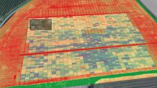
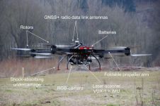
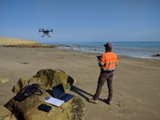
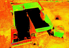
Found 489 results
Sort by

Full Frontal Mapping in 3D

Cliff surveys are traditionally performed with fixed-wing aircraft that collect nadir photos. However, one particular California bluff required the cliff’s face to be surveyed for an erosion study. A photogrammetry...

Read more

Q&A: The Quickly Evolving UAS Mapping Market

Drones have become a standard tool for mapping and surveying. Read what Gilles Labossière, CEO of senseFly, has to say about the market trends, technical developments and challenges affecting geospatial professionals. Even...

Read more

Submit Your Drone Mapping Story!

Drones – professionally referred to as unmanned aerial vehicles (UAVs) or unmanned aerial systems (UASs) – have been a key topic of GIM International over the last years. Equipped with an...

Read more