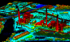
NavVis, an innovator in indoor mobile mapping, has introduced the Cloud Processing Add-on for NavVis IndoorViewer, a cloud-based tool designed to enable users to quickly and easily convert laser scans into survey-grade, photo-realistic point clouds from data captured by NavVis M6 and the new wearable device, NavVis VLX. The fully integrated NavVis indoor mapping solution is relied upon by laser scanning service providers, professional surveying firms, and Architecture/Engineering/Construction (AEC) companies. “We wanted to offer our users a processing tool that significantly speeds up and simplifies their workflows, so they can benefit both in the short and long term,” said Lisa...
(read more)