Significant leap forward for UAV-Lidar mapping
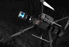
DJI selected Intergeo in Berlin as the stage for unveiling the DJI Zenmuse L2. This highly integrated Lidar system builds on the success of DJI’s Zenmuse L1 to bring new...
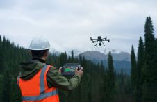
DJI selected Intergeo in Berlin as the stage for unveiling the DJI Zenmuse L2. This highly integrated Lidar system builds on the success of DJI’s Zenmuse L1 to bring new...

A global audience of geospatial professionals witnessed the presentation of the JOUAV VTOL Hangar, a groundbreaking development in the field of vertical take-off and landing (VTOL) drones, at Intergeo 2023....
On 24 January 2023, the European Union declared the Galileo High Accuracy Service (HAS) operational for testing, and it is scheduled to become fully operational in 2024. This free signal adds...
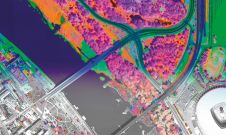
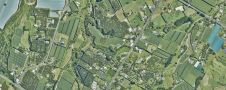
A pioneering project in Poland has proved that aerial mapping, combined with Lidar technology, can be an invaluable tool for accurately mapping the green urban environment. In fact, the new,...
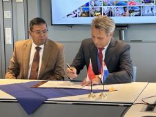
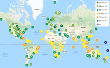
Dutch Kadaster and the Indonesian National Land Agency have signed a new Memorandum of Understanding (MoU). The two parties have been collaborating on the modernization and digitalization of land registration...

Rapid advancements and improvements in technology have made a huge difference to surveying techniques and solutions. Such a densely populated market of devices can feel overwhelming, leaving buyers baffled as...
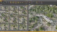
Virtual Surveyor has added drone photogrammetry capabilities to the latest release of its popular Virtual Surveyor smart drone surveying software. The new Terrain Creator app photogrammetrically processes drone photos to...
Balko Tech has launched Connectiv, the next evolution of its modular drone Lidar system. This release also includes the introduction of the e-Connect application. Following the success of the e-ONE...
Land Information New Zealand has made 20TB of aerial imagery available for free for the first time in a cloud-optimized format on Amazon Web Services (AWS), making it easier and...

In a new partnership, Sanborn will use Pixxel’s hyperspectral dataset to equip its customers with advanced insights to solve problems as varied as agriculture crop and forestry health monitoring, exploration for...
This site uses cookies. By continuing to use this website, you agree to our Cookies Policy. Agree