Predicting the future by mapping the past
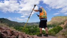
Lidar change detection (LCD) is one of the most capable techniques for mapping changing terrain through time. It can be applied in billion-dollar decisions to design, build and operate tunnels,...
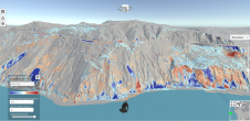
Lidar change detection (LCD) is one of the most capable techniques for mapping changing terrain through time. It can be applied in billion-dollar decisions to design, build and operate tunnels,...

An increasing number of cities are creating 3D city models to support visualization and simulations in the urban planning process. The 3D city models are often extended with planned buildings....
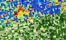
Emerging satellite data providers ConstellR and ScanWorld have announced a new partnership which aims to leverage combined Earth observation expertise to provide data-driven insights for agriculture and vegetation monitoring. The...
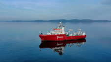
Fugro has completed the offshore fieldwork phase of a high-profile multidisciplinary contract for Global Marine that will help determine subsea routes for 16 new fibre-optic cables in the Scottish archipelago...
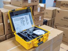
Tersus GNSS has been awarded a major order for 185 Oscar GNSS receivers in Nigeria. This order will further strengthen the position of Tersus in Africa. Tersus has also been...
During the early days of Global Positioning System (GPS) technology in the 1980s and 1990s, surveyors had to chase satellite geometry and spend long hours collecting data in order to...

FIG Honorary Member James R. Smith, born in 1935, sadly passed away on 12 August 2021. Jim Smith qualified as a Land Surveyor in 1961 and had been an active...
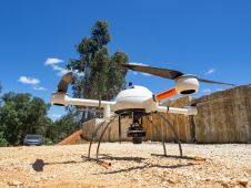
The mission: capturing 21 quarries in 60 days. Squeezed into that timeframe were planning and performing the UAV photogrammetry flights, editing the RAW images, processing the data, extracting the topography using Virtual Surveyor, and production of the orthophotos, Digital Surface Model (DSM), Digital Terrain Model (DTM) and contour maps for each site. The main client, a government institute, needed highly precise and reliable 3D models and maps fast, as well as data their engineers could work with in a CAD environment. “There was a lot of pressure because of the short timeline”, said Nuno Santos, owner and CEO of Aerisurvey, a Mangualde, Portugal-based company specialized in high-precision UAV surveying. Mapping 21 Quarries in 60 Days The mission was to capture 21 quarries in 60 days. Squeezed into that timeframe were planning and performing the UAV photogrammetry flights, editing the...
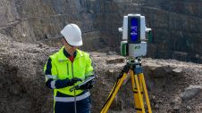
A new dual-window scanner that halves data capture time headlines the latest Maptek mine measurement improvements. The new Maptek XR3-D mkII laser scanner with dual-window arrangement is designed to cut...
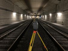
GeoNext has used Trimble technology to survey the Schiphol Tunnel and provide measurements as the basis for a 3D model to support essential railway maintenance and upgrades. Millions of passengers...
This site uses cookies. By continuing to use this website, you agree to our Cookies Policy. Agree