Kristen Maglia
Kristen Maglia is senior product marketing manager at Esri. She started her marketing career in imagery analysis software immediately after graduating from Colorado State University, and has had the unique...

Kristen Maglia is senior product marketing manager at Esri. She started her marketing career in imagery analysis software immediately after graduating from Colorado State University, and has had the unique...

Arkadiusz Szadkowski is senior business development manager of reality mapping, imagery & remote sensing at Esri. He is passionate about leading the change towards 3D GIS and bridging the gap...

Both vertical and oblique aerial images have their own advantages, making them valuable in different reality mapping applications. So how can you choose between the two? This comparison will help...

Anna Jarvis is Trimble Applanix’s land mobile mapping product manager, focused on product development for the industry. After graduating with a master’s degree in Geomatics Engineering from the University of...
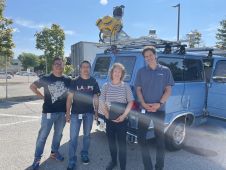
It can still be difficult to achieve centimetre-level accuracy in mobile mapping, especially in GNSS-denied or challenging areas such as in deep urban canyons, under foliage or through tunnels. However,...

In a high-flying endeavour spanning over six decades, the UK’s National Grid's fleet of advanced helicopters have been diligently patrolling pylons and power lines, ensuring the health and reliability of...
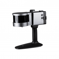
ComNav has announced the launch of its latest innovation: the LS300 3D laser scanner. This addition to the company's product lineup signifies a significant leap forward in addressing the dynamic...
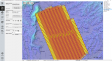
The TatukGIS Developer Kernel (DK) plays a key role in the Topoflight software suite (Missionplanner for optimal flight paths, and Navigator for precise data acquisition). In the realm of vast...

Recently unveiled by Vexcel Imaging, the groundbreaking UltraCam Dragon 4.1 represents one of the market's most advanced, progressively designed and seamlessly integrated hybrid aerial mapping systems. Tailored for high-resolution mapping...
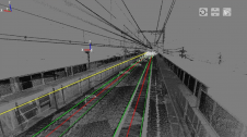
Nippon Insiek and SITECO Informatica have announced the provision of an advanced road-scanner system to Japan’s leading railway company, JR East, to support JR East’s response to the quest for...
This site uses cookies. By continuing to use this website, you agree to our Cookies Policy. Agree