How Real-time Monitoring Reduces Water Losses
Real-time monitoring can reduce long-term losses caused by holes across a network of water pipes. At 6 bar pressure, a pipe with a 6mm hole will leak 1.8 cubic metres...
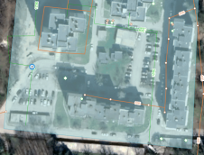
Real-time monitoring can reduce long-term losses caused by holes across a network of water pipes. At 6 bar pressure, a pipe with a 6mm hole will leak 1.8 cubic metres...
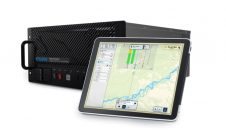
Teledyne Geospatial has released the Galaxy Onboard, a workflow-focused solution that enables airborne surveyors to deliver quality-controlled processed data in real time. With Galaxy Onboard, Teledyne Geospatial has lowered the...

As we enter the era of smart manufacturing, the reliability of data is growing in significance and data standardization is becoming increasingly important. According to JP Kelly, associate director and...
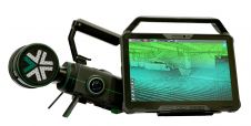
Exyn Technologies has unveiled Exyn Nexys, an innovative modular 3D mapping solution. Designed for professionals in the mining, construction, AEC and geospatial industries, Nexys aims to set a new standard...
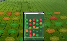
Sentera FieldAgent now delivers instant plant population and weed pressure reports in the FieldAgent mobile app while the drone is still in flight. Agriculture professionals can obtain up to 100...

The Commonwealth Scientific and Industrial Research Organisation (CSIRO) has released a crop monitoring app called Graincast. It combines data from satellites, sensors, climate forecasts and historical yield data, giving farmers...
Disturbing figures on air quality and UV solar radiation have resulted in a booming interest in environmental public health monitoring. Especially regarding UV radiation and atmospheric composition, real-time health-risk probing...
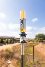
Topcon Positioning Systems has presented the latest addition to its HiPer family of global navigation satellite system (GNSS) receivers. The HiPer CR is a compact and lightweight GNSS receiver designed...
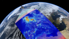
Scientists, satellite operators, insurance industry and government officials gathered on 7 February 2014 to discuss the latest advances in forecasting and ‘nowcasting’ that, for the first time, enable ‘real-time’ risk...
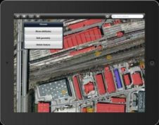
Intergraph, USA, has launched Intergraph Mobile MapWorks, a practical tool for performing on-the-fly field updates of geospatial information. Intergraph Mobile MapWorks is an iOS and Android tablet-based app for viewing,...
This site uses cookies. By continuing to use this website, you agree to our Cookies Policy. Agree