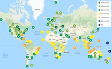
The role of surveyors in building climate resilience
New knowledge and tools are needed if surveyors are to fulfil their critical role along the path to achieving humanity’s global climate goals related to land, water and the marine...

New knowledge and tools are needed if surveyors are to fulfil their critical role along the path to achieving humanity’s global climate goals related to land, water and the marine...
On 24 January 2023, the European Union declared the Galileo High Accuracy Service (HAS) operational for testing, and it is scheduled to become fully operational in 2024. This free signal adds...
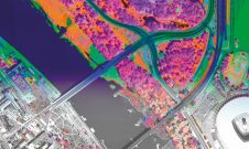
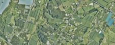
A pioneering project in Poland has proved that aerial mapping, combined with Lidar technology, can be an invaluable tool for accurately mapping the green urban environment. In fact, the new,...

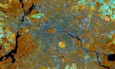
From 10 to 12 October, the vibrant capital city of Germany will be the epicentre of geoinformation innovation as it hosts Intergeo Expo and Conference. With a rich array of...
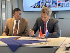
Dutch Kadaster and the Indonesian National Land Agency have signed a new Memorandum of Understanding (MoU). The two parties have been collaborating on the modernization and digitalization of land registration...

Adina Gillespie is the vice president of strategic initiatives at Hexagon Geosystems. With over 15 years of experience in Earth observation (EO) technology, she focuses on advancing technology and data...
In this exclusive interview, two of the driving forces behind this year's Intergeo talk about the event's evolution and impact, nurturing talent, land surveying, Earth observation and the Blue Economy....

Rapid advancements and improvements in technology have made a huge difference to surveying techniques and solutions. Such a densely populated market of devices can feel overwhelming, leaving buyers baffled as...

What are the challenges of image-based data acquisition for photogrammetric mapping and mesh modelling? And how can photogrammetry be made accessible? The annual Open Day Photogrammetry provided some answers to...
Land Information New Zealand has made 20TB of aerial imagery available for free for the first time in a cloud-optimized format on Amazon Web Services (AWS), making it easier and...
This site uses cookies. By continuing to use this website, you agree to our Cookies Policy. Agree