
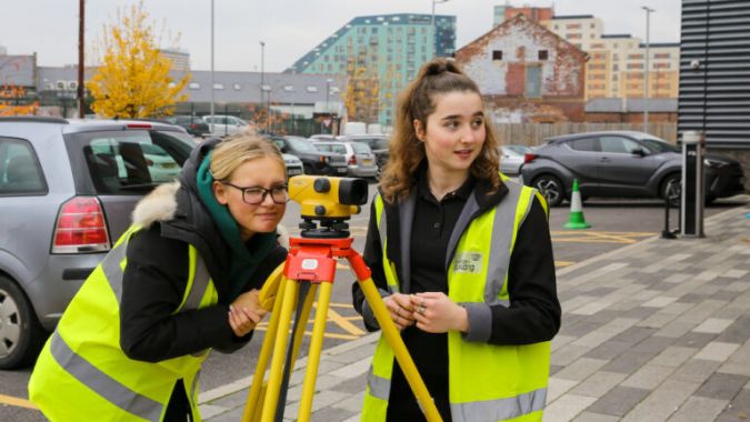
Plenty of career choices for geospatial graduates
So you'd like to do something in 'geospatial' – but what? New graduates in geomatics and surveying are extremely sought-after in the labour market thanks to their broad scientific background, solid practical training – both out in the field and at a computer – and their solution-oriented mindset. There are countless professional roles open to them, such as a surveyor or GIS specialist within company’s involved in geographical information processing and management. Alternatively, they might decide to establish themselves as an independent surveying expert, either with a government body or with a consultancy firm. Additionally, there are numerous interesting future-focused opportunities in research and education. This series of articles gives you a taste of some of the many career choices available to geospatial graduates.
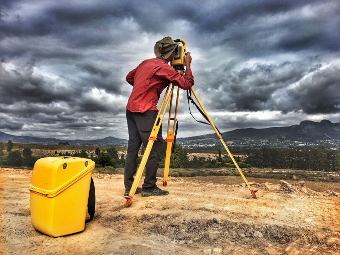
How will the surveyor’s role look in ten years’ time?
Over the next ten years, the surveyor’s workflow will become quicker, safer and easier because of new technologies such as scanning, mobile mapping and UAS photogrammetry. Virtual layout, aided by the increasing use of augmented reality technologies, will require fewer physical stakes in the ground. Due to the transformation of the physical world into a digital one, digital twins will take centre stage, with surveyors called upon to convey meaningful information from the model back to the physical world.
Bridging the gap between aerial imaging and terrestrial data capture
There have been rapid advancements in unmanned aerial systems over recent years, yet there is widespread consensus that we have still only seen a fraction of how unmanned aerial vehicles (UAVs or ‘drones’) could ultimately improve efficiency for geospatial professionals and their customers. To get a glimpse of the future, GIM International spoke to Mark Nicolai, co-founder of industry start-up Aeroscan. Here, he shares his vision of how drones could form the missing link between aerial imaging and terrestrial data capture.
How geoinformation enhances professional football
This interactive pass map uses techniques from geoinformation science to highlight passing patterns in a new and innovative way. The visual exploration and analysis of passing patterns helps professional football clubs to understand how individual players perform and how their style affects the team performance. However, most clubs lack sufficient knowledge to analyse large and complex datasets themselves. This article explains how the pass map highlights passing patterns in an intuitive manner with a focus on geovisual analytics.
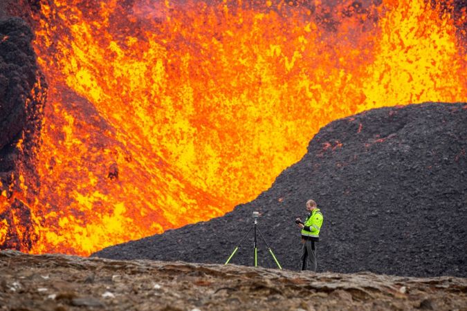
Surveying in the land of fire and ice
Geodesists and surveyors in Iceland face considerable challenges due to the deformation effects of earthquakes, volcanic eruptions and glaciers on the geodetic networks. This article provides insight into the impact of this dynamic situation on the country’s geodetic datums over the past decades.
Mobile app to accelerate land administration in Indonesia
A mobile app has been developed to improve the success of cadastral survey implementation in Indonesia. The country has set itself ambitious land registration targets by 2025. The national cadastral survey app called Survey Tanahku (‘My Land Survey’) is connected to external sensors for geodetic measurements and also to civil registry services. This solution turns cadastral survey from costly and inefficient into efficient and affordable.
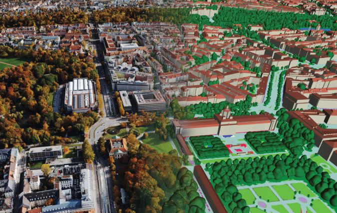
How 3D modelling supports game-changing urban development
Accurate digital representations of cities are game changers in urban development. By enabling virtual modelling and smart simulations, they allow decision-makers to explore, test and assess the measures taken. Hosted on cloud-enabled platforms, these digital twins also facilitate collaboration among stakeholders who can jointly optimize for outcomes that make cities smarter, safer, more livable and more sustainable.
Kinematic laser scanning in assessing urban land use and utility infrastructure
How can kinematic laser scanning support urban planning and infrastructure management? Urbanization and the development of megacities is posing critical challenges for sustainable but efficient land use globally. Power lines, pipelines for water, district heating, gas and oil, and other technological systems are critical yet often hidden assets facilitating today’s lifestyles. Meanwhile, there is an ever-important need to preserve natural environments and recreational spaces in the world’s cities, despite the pressure to spread more concrete and asphalt to accommodate the people and businesses flocking to them. This article examines the role of kinematic laser scanning.

Value staying current with geomatics?
Stay on the map with our expertly curated newsletters.
We provide educational insights, industry updates, and inspiring stories to help you learn, grow, and reach your full potential in your field. Don't miss out - subscribe today and ensure you're always informed, educated, and inspired.
Choose your newsletter(s)


