Updating the Cadastre in Ecuador
Photogrammetry and Lidar were used together in Ecuador to detect irrigation and drainage canals for a project aiming to improve irrigation methods and create the related land registry. The integration...

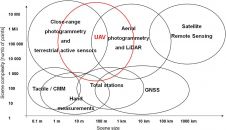
Remote sensing is all about gathering information on the earth using techniques that are ‘at a distance’ rather than touching the earth. Generally speaking remote sensing produces either point cloud data or imagery. The data is further processed using [geographical information systems] as part of [cartography].
Often Remote Sensing is differentiated by the type of platform or sensor used. Platforms can range from satellites through aircraft and drones to cars and ships. From a sensor perspective, Remote Sensing is a broad field that encompasses techniques such as [photogrammetry] and [lidar] but also [echosounding]. Often a form of ground truthing is required to transform the Remotely Sensed data into comprehensible products.
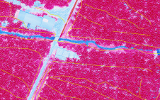
Photogrammetry and Lidar were used together in Ecuador to detect irrigation and drainage canals for a project aiming to improve irrigation methods and create the related land registry. The integration...
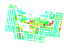
The urbanization trend is leading to an increasing number of people living in cities, thus also placing new demands on cadastral registration. To be able to register the complex infrastructures and bu...

As residential real estate prices continue to climb in many parts of the United States, property owners are increasingly investing in renovations and additions to their existing homes. To meet the dem...

Combining big data with satellite imagery can help cities such as Kampala, the capital of Uganda, to better prepare for natural disasters such as urban flooding and make more informed investment decis...
This innovative approach to measuring 3D urban growth integrates Lidar processing with machine learning. It takes account of the specific needs of urban planners, is less complicated to run and addres...
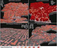
Hannes Taubenböck and his team at the German Aerospace Center (DLR) are using very high-resolution (VHR) satellite imagery, supplied by European Space Imaging, combined with auxiliary surveys to deve...

Precision forestry technology is moving forward at an amazing pace, with advancements in global positioning systems, remote sensing platforms and data sources, cloud geospatial engines, mobile GIS dat...

This year, NASA is celebrating the 50th anniversary of the first crewed mission – Apollo 11 – landing on the moon. Besides that, this September it will be 60 years since the first unmanned mission...
Over the past decade, Geosud has contributed to successfully mitigating the various obstacles to the operational use of satellite imagery for environmental management and territorial development. Geos...

In June this year, the Dutch city of Enschede welcomed the photogrammetry and remote sensing community for the ISPRS Geospatial Week 2019 (GSW2019). Whether to attend presentations, such as on ‘Faç...
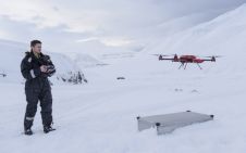
Drones are playing a crucial role in vital work to better understand the effects of climate change in the Arctic. Dr Joseph Cook, a glaciologist at the University of Sheffield, is conducting major res...
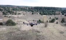
A team of researchers have used a range of drones, including a DJI M600 Pro supplied by Heliguy, to complete the most comprehensive survey of Chernobyl’s Red Forest – one of the most radioactiv...
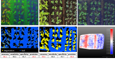
Precision agriculture has considerably benefited from the use of unmanned aerial vehicles, often combined with active ranging sensors like Lidar to gather information from underneath the crops, but ex...

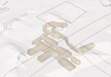
A pilot project conducted at a university campus in Curitiba, Brazil, aimed to create outdoor maps using UAS photogrammetry as well as indoor floor plans. At universities, facility managers and other ...
The mapping of historical cultural features, which we will call heritage mapping, is mainly based on photogrammetric methods. Mapping for this purpose has been going on for many years using a great va...
This site uses cookies. By continuing to use this website, you agree to our Cookies Policy. Agree