Spatial Data Quality Degradation
The competitiveness of an organisation is negatively affected by poor data quality, as introduced through the multitude of transformations and transfers carried out on original data. One risk involves uncontrolled...
The competitiveness of an organisation is negatively affected by poor data quality, as introduced through the multitude of transformations and transfers carried out on original data. One risk involves uncontrolled...
The Norwegian company Terratec has introduced software capable of accurate positioning based on post-processing of GPS-observations, without the use of reference stations or DGPS services. Typical accuracy for kinematic applications...
Magellan Z-Max.Net has has been qualified for the new French GPS Reference Network Teria. Originally planned by the Ordre des Géomètres-Experts (French Surveyors Union) to facilitate the work of its...

CyberCity AG (Switzerland) has extended its library of European 3D city models with two impressive datasets: Paris and Florence. Paris 3D is a highly detailed 3D model of the city...
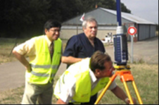
The classical geodesist’ dream of a dense, accurate, reliable and homogeneous countrywide levelling control network is a luxury even for the richest countries and will probably remain a dream. Prior...
This is the second Product Survey on Airborne Lidar Sensors; the last appeared under the title ‘Airborne Laser-scanners’ in our May 2004 issue. Seven companies were willing to co-operate by...
KOREC (United Kingdom) has launched a new system that makes RTK cm precision GPS a viable solution for the mapping market. By combining a Trimble RTK GPS Receiver, Trimble’s VRS...

Applanix (Canada) has introduced POSPac AIR Version 4.4, a post-processing software used to extend the accuracy potential of the POS AV system. Designed to maximise data quality and optimise workflow...
NovAtel Inc. (Canada) has released its Version 7.80 GrafNav/GrafNetTM, GrafNav/GrafNet Static, GrafNav Lite and GrafMov post-processing software. This latest software release includes significant advancements such as Precise Point Positioning (PPP),...
The company Pictometry has patented an aerial imagery technology based on acquiring oblique digital images and primarily developed as an imagery visualisation tool. Oblique: I know what that is, but...
This site uses cookies. By continuing to use this website, you agree to our Cookies Policy. Agree