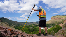
Use of GIS tools for land expansion in Colombia
Local indigenous youngsters in northern Colombia have mapped the boundaries and sacred sites of their village, Gunmaku in the Sierra Nevada of Santa Marta, and the indigenous authorities are happy...
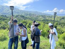
Local indigenous youngsters in northern Colombia have mapped the boundaries and sacred sites of their village, Gunmaku in the Sierra Nevada of Santa Marta, and the indigenous authorities are happy...

Trimble has introduced data integrity monitoring for its precise point positioning (PPP) correction service, CenterPoint RTX Fast. The Trimble RTX Integrity monitoring system is an innovative, patented solution, built in...
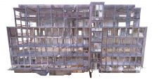
When Bybanen Utbygging was hired for the complex Bergen Light Rail Project in Norway, it decided to go paperless and provide all building information for Phase 4 via 3D BIM models....
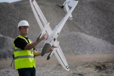
Propeller Aero and Quantum-Systems are working together to ensure compatibility of Propeller’s site surveying and 3D mapping software with Quantum-Systems’ Trinity F90+ UAV. Propeller Aero is a drone data visualization and analytics platform,...
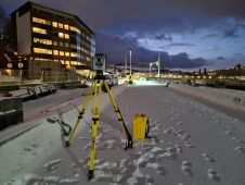
Terrestrial laser scanning is becoming increasingly important as the software and technology-related developments in many spheres of society mean that ever-higher standards are being set in terms of quality and...
What is the current state of GNSS, from both a constellation, augmentation and receiver perspective? Spoiler alert: it is more of an evolution than a revolution! It is almost impossible...

Besides the surveying hardware & software and the intricacies of BIM and data exchange, this article explores broader aspects of digitalization in the construction industry. How are they affecting the...

In this interview, Ron Bisio, senior vice president of Trimble Geospatial, provides his views on the key market trends, technology drivers and challenges, and the impacts of COVID-19 and climate...
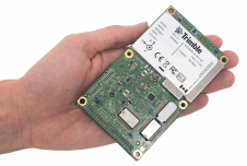
Applanix, a Trimble company, has announced the Trimble AP+ Land GNSS-inertial OEM solution for accurate and robust position and orientation for georeferencing sensors and positioning vehicles in land mobile mapping...

Sadly, Prof Dr Fritz Ackermann passed away at the age of 92 on 4 December 2021. He was a professor of photogrammetry and surveying at the University of Stuttgart in...
This site uses cookies. By continuing to use this website, you agree to our Cookies Policy. Agree