The versatility of UAVs for mapping and surveying
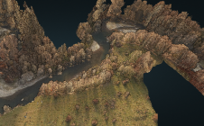
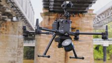
In recent years, the UAV has outgrown its status as a disruptor to become a standard part of the surveyor’s toolkit for capturing the environment. One thing that makes the...
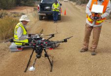
In recent years, the UAV has outgrown its status as a disruptor to become a standard part of the surveyor’s toolkit for capturing the environment. One thing that makes the...
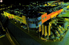
Complementary and Consistent: Duo of Trimble MX50 and X7 Saves French Company Time Capturing Precise Data By capturing data with a combination of two Trimble solutions, Neocapture, a young French...
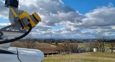
Terrestrial laser scanning is becoming increasingly important as the software and technology-related developments in many spheres of society mean that ever-higher standards are being set in terms of quality and...
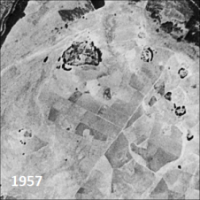
Only a small fraction of the information content in aerial films has ever been recorded on paper maps, most of which are inaccessible. The use of artificial intelligence (AI) to...
The monitoring of submerged deadwood and vegetation is gaining increased attention due to their socio-economic and ecological importance. Deadwood acts as an important underwater habitat but also poses a threat...
Emesent has launched Hovermap ST, the latest version of the Hovermap autonomy and mapping payload. The tough, lightweight, IP65-rated Hovermap ST includes Emesent’s new automated ground control feature. With this powerful...
Arrowhawk Imaging has selected an UltraCam Eagle Mark 3 aerial camera system with a 100mm lens as its first airborne imaging system. Since purchasing the sensor from Vexcel Imaging in...
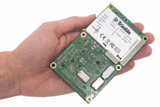
Applanix, a Trimble company, has announced the Trimble AP+ Land GNSS-inertial OEM solution for accurate and robust position and orientation for georeferencing sensors and positioning vehicles in land mobile mapping...
RIEGL has recently released its software suite for processing kinematic Lidar data: RiPROCESS 1.9.2. The software and the associated tools provide additional benefits for processing RIEGL kinematic laser scan data....
In the wake of Hurricane Henri and Hurricane Ida, Applanix, a Trimble Company, and NOAA recently collaborated to provide critical information to first responders. Applanix’s high-accuracy direct georeferencing (DG) technology...
This site uses cookies. By continuing to use this website, you agree to our Cookies Policy. Agree