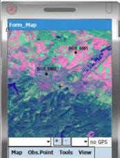
Mobile Geological Mapping Software
GAF has released a free trial version of GeoRover, a mobile geological mapping software, developed on the basis of experience gained from real geological mapping field work. The software integrates...
GAF has released a free trial version of GeoRover, a mobile geological mapping software, developed on the basis of experience gained from real geological mapping field work. The software integrates...
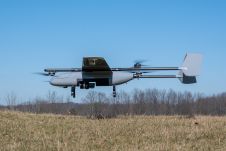
In a new strategic partnership, Inertial Labs' RESEPI Payload Lidar technology will be integrated into E38's advanced E455 drone platform. This collaboration marks a significant milestone in the utilization of...
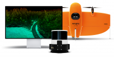
Wingtra has unveiled its innovative Lidar-drone solution. The new Lidar payload is designed to seamlessly integrate the efficiency, ease of operation, and high accuracy of the WingtraOne GEN II drones...
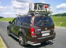
Gispro have successfully implemented Land Based Mobile Mapping System (MMS/MLS). The system consists of Riegl laser scanners, digital videoscanners and ground-penetrating radar. Positioning and orienation are established using POS420 and...
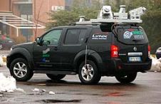
The use of Mobile Lidar systems enters the scene when large areas have to be surveyed at accuracy and resolution exceeding those available through aerial photogrammetry, and when using static...

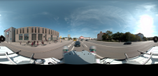
Both vertical and oblique aerial images have their own advantages, making them valuable in different reality mapping applications. So how can you choose between the two? This comparison will help...
FARO has announced the acquisition of one the world's mobile scanning market leaders: GeoSLAM. With proprietary high-productivity simultaneous localization and mapping (SLAM) software to create 3D models for use in...
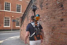
Large amounts of personal data, such as faces and number plates, are collected during mobile mapping. Receiving consent from individuals for large-scale data collection is not feasible but is required...

The AlphaUni 20 (AU20) Lidar system represents a new era in cost-effective, multi-platform mobile mapping solutions, according to CHC Navigation (CHCNav), a global leader in precision mapping, positioning and navigation...

Mobile mapping is well past the tipping point and is about to go mainstream. Read this column by Felix Reinshagen to find out why. In his previous column about the...
This site uses cookies. By continuing to use this website, you agree to our Cookies Policy. Agree