From Data Capture to Data Intelligence
In this interview, Ron Bisio, senior vice president of Trimble Geospatial, provides his views on the key market trends, technology drivers and challenges, and the impacts of COVID-19 and climate chang...

In this interview, Ron Bisio, senior vice president of Trimble Geospatial, provides his views on the key market trends, technology drivers and challenges, and the impacts of COVID-19 and climate chang...
What is the current state of acceptance of mobile mapping, and what are its most common applications? A worldwide survey commissioned by NavVis, and supported by 'GIM International' plus three other ...
How is the geospatial industry evolving in today’s turbulent times? The climate crisis, the COVID-19 pandemic, shifting geopolitical balances – societal challenges are having a major impact on the...

Today, after 100 years of continuous innovation in airborne photogrammetry, entire countries can be mapped faster than ever before. Which advancements and trends have dirven the demand for geospatial ...

'GIM International' invited Bisheng Yang, vice-director of LIESMARS at Wuhan University, to share his thoughts on the present and future of the geospatial industry. Here, he provides his views on the ...

Data visualization is inherent to humans and continuously evolves, driven by innovation. How is GIS playing a role in this? The term 'data visualization' has come into popular usage relatively recentl...
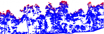
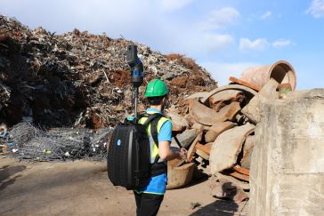
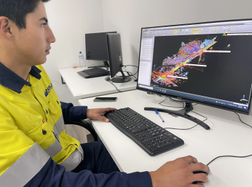
Terrestrial laser scanning is increasingly being fused with air/spaceborne Lidar to characterize vegetation structure across a range of forest ecosystems. This article explores the potential of this a...
A special issue of the 'Land' journal highlights the latest Fit-For-Purpose Land Administration innovations, demonstrating that FFPLA is increasingly gaining momentum and acceptance. The Fit-For-Purpo...
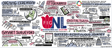
Bringing together over 1,300 participants from all over the world for a week packed with inspiring sessions, the FIG e-Working Week can be regarded as a success story of the new reality. It took place...
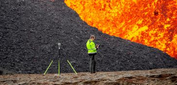
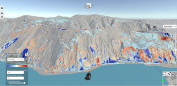
Geodesists and surveyors in Iceland face considerable challenges due to the deformation effects of earthquakes, volcanic eruptions and glaciers on the geodetic networks. This article provides insight ...
To reflect the changing nature of our industry and attract much-needed future talent, perhaps it’s time to rebrand surveyors as ‘geospatial astronauts’, writes Wim van Wegen in his latest column...

GIM International asked organizers Christoph Hinte from Hinte Messe and Christiane Salbach from DVW to look back on the most recent Intergeo and also to share a glimpse of next year’s event. Interge...

The diversity of relief mapping methods and the existence of large elevation databases intended for multiple users raises the issue of DEM quality. Digital elevation model (DEM) accuracy is commonly a...
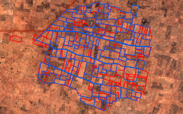
Lidar change detection (LCD) is one of the most capable techniques for mapping changing terrain through time. It can be applied in billion-dollar decisions to design, build and operate tunnels, bridge...
We encourage you to subscribe to our weekly newsletter. Subscribers also receive a digital copy of our bi-monthly magazine.
This site uses cookies. By continuing to use this website, you agree to our Cookies Policy. Agree
