Airborne Lidar Survey to Help Find Lost Village
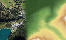
Aerial mapping company Bluesky is to use Lidar to produce a highly detailed 3D map of the National Trust's Wallington Estate in Northumberland, England. The survey will bring to life...

Aerial mapping company Bluesky is to use Lidar to produce a highly detailed 3D map of the National Trust's Wallington Estate in Northumberland, England. The survey will bring to life...
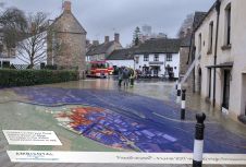
3D terrain data from aerial mapping company Bluesky is being used to upgrade the first national climate change flood model for Great Britain. Created by Ambiental Risk Analytics as part...

SimActive has announced the release of Correlator3D version 8.6. The new version includes multiple new features, such as the use of intensity data from LAS files for image registration, the...
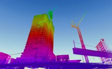
When it comes to 3D modelling for construction, what are the advantages and disadvantages of photogrammetry versus Lidar in terms of accuracy, complexity and cost? Breaking away from laser measurement...
Vexcel Imaging has released UltraMap version 5.0, the latest update of its all-in-one aerial photogrammetry software featuring comprehensive DTM generation and full integration of orthophoto production in UltraMap Studio. With the introduction of a completely new Digital Terrain Model...
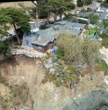
Cliff surveys are traditionally performed with fixed-wing aircraft that collect nadir photos. However, one particular California bluff required the cliff’s face to be surveyed for an erosion study. A photogrammetry...

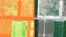
Aerial mapping specialist Bluesky International has announced new plans to photomap the whole of Great Britain at 12.5 centimetre resolution – its highest level of detail for nationwide coverage to...
SimActive, the Canada-based leading developer of photogrammetry software, has announced the release of Correlator3D version 8.5. The new version allows users to share and visualize projects in the cloud. It...
Bluesky International has announced that new ultra-high resolution aerial city photography is now available online, together with updated countrywide data, providing users with access to real-world locations from the safety...
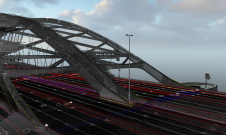
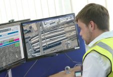
The Van Brienenoordbrug bridge is the busiest in the whole of the Netherlands, with an average of 235,000 vehicles driving over it every day. Approximately 150,000 ships and boats pass...
This site uses cookies. By continuing to use this website, you agree to our Cookies Policy. Agree