Counting Down to Intergeo 2022
Preparations for Intergeo 2022, the world’s leading conference and trade fair for the geodesy, geoinformation and land management community, are in full swing. This year’s event, featuring three full days...

Preparations for Intergeo 2022, the world’s leading conference and trade fair for the geodesy, geoinformation and land management community, are in full swing. This year’s event, featuring three full days...

Dr Diane Dumashie won the final vote at the FIG Congress 2022 in Warsaw and will serve as the next president of FIG for the next four years. She stated...
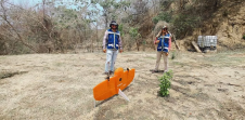
A local geospatial company called Omphika is using the WingtraOne UAV to improve land management in Mexico. Only about 300 of the nation's 2,500 counties currently have proper cadastral studies...
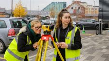
So you'd like to do something in 'geospatial' – but what? New graduates in geomatics and surveying are extremely sought-after in the labour market thanks to their broad scientific background,...

HTS-521L10 is Hi-Target's new generation high-precision long-range total station. The inspiration for its cool and refreshing appearance comes from the Bumblebee. A tough exterior provides evidence of its durability and the colour...

Capturing and measuring the environment in the Arctic and Antarctic is a particularly challenging job. The area of interest is often covered by a thick blanket of snow and ice,...
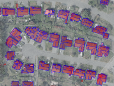
How can artificial intelligence and deep learning lead to a robust process for 3D city modelling? And what are some of the challenges? Automated classification and object detection in Lidar...

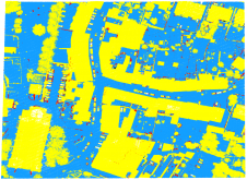
Read this guide to the main 3D data representation methods to understand the key differences and choose the best method for your specific applications. The 3D data jungle in today’s...
As a division of machine learning, deep learning (DL) has been achieving unparalleled success in image processing and recently demonstrated huge potential for point cloud analysis. Precise ground surface topography...
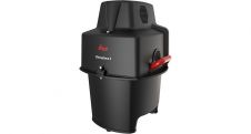
Leica Geosystems, part of Hexagon, has announced the introduction of Leica Chiroptera-5, the new high-performance airborne bathymetric Lidar sensor for coastal and inland water surveys. This latest mapping technology increases...
This site uses cookies. By continuing to use this website, you agree to our Cookies Policy. Agree