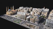
How digital twins add value in urban planning
As more and more cities are deciding to work with a digital twin, we have selected a number of articles that outline how digital twins are created and how they...
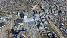
As more and more cities are deciding to work with a digital twin, we have selected a number of articles that outline how digital twins are created and how they...
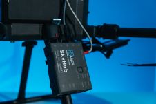
SPH Engineering has announced the third generation of the UgCS SkyHub hardware and released the largest update of the UgCS SkyHub software ever. The development accumulates five years of knowledge...
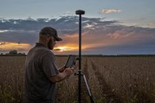
Juniper Systems has introduced the all-new Geode GNS3 GNSS receiver. It enables users to easily collect real-time GNSS data with sub-metre, sub-foot and decimetre accuracy options – without the huge price tag...
CHC Navigation (CHCNAV) has released the AlphaAir 1400 (AA1400) and AlphaAir 2400 (AA2400) Lidar systems. Both solutions are compact airborne laser scanners that are easily installed on various UAV platforms...
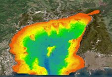
The national land agency in Jamaica has integrated satellite-based hydrography to benefit from time efficiencies, cost savings and improved safety as part of its hydrographic programme in support of the...
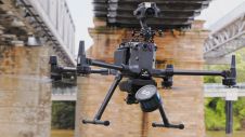
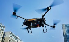
Emesent has launched Hovermap ST, the latest version of the Hovermap autonomy and mapping payload. The tough, lightweight, IP65-rated Hovermap ST includes Emesent’s new automated ground control feature. With this powerful...
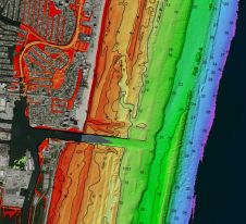
Woolpert has been granted a patent by the United States Patent and Trademark Office for its ‘Airborne Topo-Bathy Lidar System and Methods Thereof’. A Lidar sensor system was developed by...
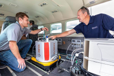
95West Aerial Mapping has completed integration and training, finalizing the delivery of RIEGL VQ-1560 II-S airborne laser scanners. The new Lidar system, with its doubled laser power and high pulse frequency, is...
Following the devastating explosion of an ammonium stockpile in Beirut in August 2020, a UAV mapping project was rapidly initiated to assess the damage. The project was led by Augment,...

'GIM International' spoke to Blickfeld, a developer of Lidar sensors and software, to hear about other potentially relevant applications in smart cities, besides for autonomous driving. Despite the name, a self-driving...
This site uses cookies. By continuing to use this website, you agree to our Cookies Policy. Agree