SDG 11 as a ‘Glocal’ Framework
In urban planning, there is a case for stronger connections between global and local (‘glocal’) issues, strategies and actions. How can the Sustainable Development Goals (SDGs) help local governme...
An extensive archive of all articles published on GIM International

In urban planning, there is a case for stronger connections between global and local (‘glocal’) issues, strategies and actions. How can the Sustainable Development Goals (SDGs) help local governme...

Read this interview with Topcon's Ulrich Hermanski for his views on the current status of the surveying profession, the key advances and the future role of surveyors. Since graduating in Geomatics Eng...
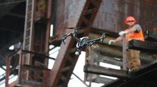
The arrival of unmanned aerial vehicles (UAVs or ‘drones’) has democratized the Lidar market forever. Everyday projects can be flown easier and faster, and sensors are getting lighter, more accura...
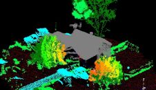
How can the dense point clouds that originate from 3D mapping be turned into useful game engine scenes? This article considers issues including point classification and segmentation, geometric accurac...
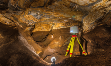
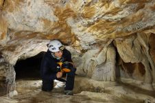
TLS and SfM photogrammetry have been used for the geodetic surveying and 3D mapping of the Ochtiná Aragonite Cave in Slovakia. This world-famous karst landscape of significant geological, geomorpholo...
The use of UAV-Lidar is being tested in the complex terrain of the Chernobyl Exclusion Zone. The aim of the University of Bristol team is to demonstrate that, in the event of a nuclear incident, it co...
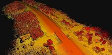
With a total length of 2,789km, the Trans-Sumatra Toll Road Project is one of Indonesia’s National Strategic Projects and the longest toll road project in Southeast Asia. In order to keep the projec...

An unprecedented scientific effort to Lidar-scan the entire surface of the Earth before it’s too late... that’s how Christopher Fisher, the founder of the Earth Archive, describes his initiative. ...
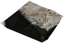
Airborne Lidar and 3D modelling technologies were used at the historic site of Fort Anne in Nova Scotia, Canada, not only as an aesthetic recreation of history, but also to help scientists decide wher...
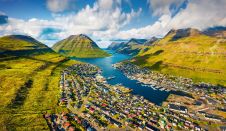
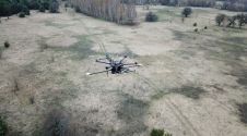
Crewless aerial mapping was recently chosen when surveying the Faroe Islands. For the small team, labour savings provided one advantage of a UAV-based approach. Another benefit was that clear skies ar...
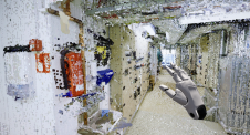
Geospatial mapping specialists and technology from GeoSLAM have been involved in a project to map the Lombrives cave in southern France. The Human Adaption Institute conducted a pioneering isolation e...
UAVs with a higher level of autonomy can make civil engineering inspections safer, faster and more accurate, plus they support the monitoring of infrastructural changes over time. The increasing devel...
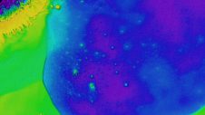
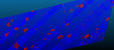
Hydrospatial could be described as that portion of geospatial knowledge infrastructure that addresses the hydrosphere, and hydrospatial technologies support navigation, economic development, stability...
Time issues associated with processing point clouds are hugely frustrating, but they are nothing new. And the shifting boundaries mean that we’re destined to forever play the waiting game, according...
A new basemap combines 360-degree aerial imagery and precise location data, providing an immersive new way to view and experience the built world from every cardinal direction. Basemap imagery offerin...
This site uses cookies. By continuing to use this website, you agree to our Cookies Policy. Agree