Geospatial Astronauts
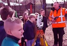
To reflect the changing nature of our industry and attract much-needed future talent, perhaps it’s time to rebrand surveyors as ‘geospatial astronauts’, writes Wim van Wegen in his latest column...
An extensive archive of all articles published on GIM International
To reflect the changing nature of our industry and attract much-needed future talent, perhaps it’s time to rebrand surveyors as ‘geospatial astronauts’, writes Wim van Wegen in his latest column...

GIM International asked organizers Christoph Hinte from Hinte Messe and Christiane Salbach from DVW to look back on the most recent Intergeo and also to share a glimpse of next year’s event. Interge...

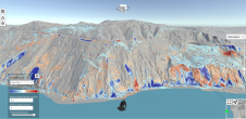
The diversity of relief mapping methods and the existence of large elevation databases intended for multiple users raises the issue of DEM quality. Digital elevation model (DEM) accuracy is commonly a...
Lidar change detection (LCD) is one of the most capable techniques for mapping changing terrain through time. It can be applied in billion-dollar decisions to design, build and operate tunnels, bridge...
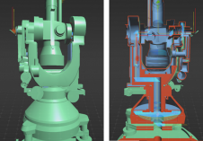
A recent project has celebrated 100 years of geodetic and photogrammetric innovation by 3D-digitizing an iconic WILD T2 theodolite from the 1927 series. An app has also been developed for Android, iOS...
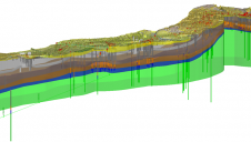
A 3D geological model has helped to save valuable time and millions of pounds for the Crossrail 2 railway project in London, UK, by identifying geological hazards along the route and informing the tun...
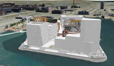
An increasing number of cities are creating 3D city models to support visualization and simulations in the urban planning process. The 3D city models are often extended with planned buildings. One way...
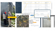
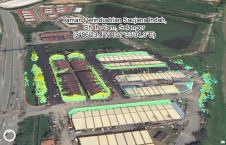
A mobile app has been developed to improve the success of cadastral survey implementation in Indonesia. The country has set itself ambitious land registration targets by 2025. The national cadastral s...
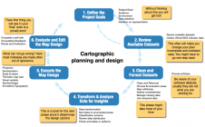
The International Cartographic Association and the United Nations recently published the book Mapping for a sustainable world. The objective was to inform those interested in visualizing SDG indicator...
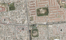
Due to the local region’s proneness to occasional wildfires, the Geomatics Division at the University of Cape Town, South Africa, has conducted research and project work around the theme of 3D reco...
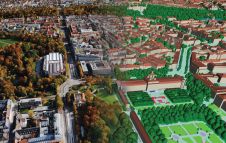
Accurate digital representations of cities are game changers in urban development. By enabling virtual modelling and smart simulations, they allow decision-makers to explore, test and assess the measu...
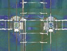
Read about this automated mobile laser scanning system developed for mining. It facilitates fast and precise measurements to produce a 3D model of the mine shaft for further analysis. Mine shafts are ...
The concept of the digital twin has been gaining significant momentum in the geospatial domain since 2016. Although there is some consensus on the basic features of a digital twin, some critical refle...

'GIM International' spoke to Blickfeld, a developer of Lidar sensors and software, to hear about other potentially relevant applications in smart cities, besides for autonomous driving. Despite the n...
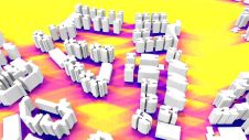
This study in Malaysia explores the use of sensor-acquired 3D point clouds as the basis for high-quality visualizations for the smart city subsurface. 3D city models are used as the underlying base fo...
This site uses cookies. By continuing to use this website, you agree to our Cookies Policy. Agree