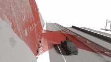
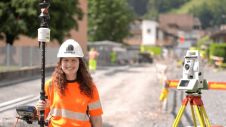
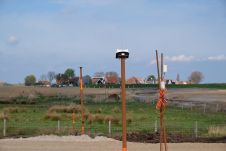
Article Archive

An extensive archive of all articles published on GIM International

Intergeo 2024 through a reporter’s eyes

Intergeo 2024 through a reporter’s eyes

What are the lasting memories after spending three days at Intergeo? Which topics, trends and solutions made the biggest impression? While far from complete, this report is a personal reflection – s...

Launch of the GeoAI Research Center

Launch of the GeoAI Research Center

Ghent University in Belgium has launched an international research centre with the aim to address geospatial problems by improving spatial reasoning and analysing capabilities of artificial intelligen...

Reflections & Resilience

Reflections & Resilience

Welcome to a special episode of Mapping the Conversations! As we approach the one-year anniversary of the podcast, we’re taking a moment to reflect on the progress made in the geospatial community o...

Cadastral copyright in Australia in the digital age

Cadastral copyright in Australia in the digital age

The move from paper-based cadastral plans to structured cadastral data is one example of how data formats can erode protection of surveyors' intellectual property in Australia. Is there a better way t...

Intergeo: the epicentre of geospatial innovation

Intergeo: the epicentre of geospatial innovation

As Intergeo marks 150 years since its inception – if we also count its predecessors – Prof Rudolf Staiger offers a compelling look at the evolution of geospatial technology and the event’s pivot...

A Look at Digital Earth Pacific with Dr. Stuart Minchin

A Look at Digital Earth Pacific with Dr. Stuart Minchin

In this episode of Mapping the Conversations, host Valrie Grant speaks with Dr. Stuart Minchin, Director-General of the Pacific Community (SPC), about the impact of geospatial technologies in the Paci...

How geospatial data enables the rollout of fast internet

How geospatial data enables the rollout of fast internet

From maps to Gbps, reality capture technology is being leveraged for fibre-to-the-home infrastructure. The digital economy is growing at an unprecedented rate, and global data consumption will increas...

Integrating connectivity and UAVs

Integrating connectivity and UAVs

Nokia hopes to leverage its communication technology expertise to make a significant impact in the market for uncrewed aerial vehicles (UAVs or 'drones'). Thomas Eder, head of Nokia’s Embedded Wirel...

Flood risk assessment via innovative geospatial data usage

Flood risk assessment via innovative geospatial data usage

Lidar and imagery data is being used to enhance urban resilience and emergency preparedness against flooding threats. This includes the integration of crowdsourced geospatial data to augment professio...

Intergeo: from geodetic roots to global innovation hub

Intergeo: from geodetic roots to global innovation hub

The DVW – Gesellschaft für Geodäsie, Geoinformation und Landmanagement (German Association for Geodesy, Geoinformation and Land Management ) – has been the driving force behind the organization ...

5 Questions to Christiane Salbach

5 Questions to Christiane Salbach

As the geospatial industry undergoes rapid transformation, this year’s Intergeo, taking place from 24-26 September in Stuttgart, is set to spotlight the most critical trends driving the field forwar...