Navigating the geospatial frontier
In this exclusive interview, two of the driving forces behind this year's Intergeo talk about the event's evolution and impact, nurturing talent, land surveying, Earth observation and the Blue Economy...
An extensive archive of all articles published on GIM International
In this exclusive interview, two of the driving forces behind this year's Intergeo talk about the event's evolution and impact, nurturing talent, land surveying, Earth observation and the Blue Economy...

What are the challenges of image-based data acquisition for photogrammetric mapping and mesh modelling? And how can photogrammetry be made accessible? The annual Open Day Photogrammetry provided some ...
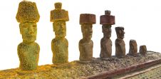
In this interview, John Ristevski, chairman and CEO of CyArk, takes us on the organization’s 20-year journey of digitally preserving cultural heritage sites. Today, the company uses advanced technol...
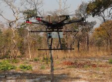
British mine-clearance charity The HALO Trust partnered with Routescene to undertake a UAV Lidar project in Cuito Cuanavale, in the Angolan province of Cuando Cubango. This case study demonstrates the...
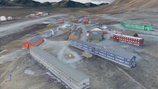
Nestled in the high Arctic Archipelago of Svalbard, the Sveagruva coal mine and mining settlement once buzzed with activity until its closure in 2016. An extraordinary project is now underway to breat...
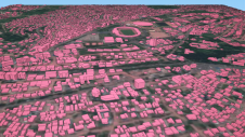
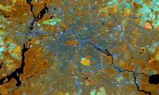
Humanitarian organizations turned to artificial intelligence (AI) to generate a comprehensive map of sub-Saharan Africa at scale and also keep it updated to reflect real-world changes. Geospatial anal...

It is time to innovate with technology that can be applied ‘right here, right now’. That was the clear message during HxGN LIVE Global 2023. President and CEO Paolo Guglielmini set the tone with h...

Through the National Registry Center (CNR), the government of El Salvador is embarking on a large-scale project to map the complete country (an area of 20,742km2), with the 14 departmental capitals an...

To provide all Beninese citizens the right to access land, bring economic prosperity and prevent land-related disputes, the Beninese government aims to establish a nationwide digital land administrati...

A new and ambitious startup called NUVIEW entered the geospatial satellite industry in May 2023, following a lengthy period in ‘stealth mode’. In this exclusive interview with GIM International, t...

Although the essence of surveying has barely changed since the profession began, the increasingly complex digital continuum requires geospatial professionals to adapt their skills in dynamic and impor...
Which factors contribute to the slow adoption of TLS in Nigeria? These insights can help to stimulate the uptake of instrumentation and enhance professional surveying in other developing countries acr...
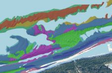
This article presents a novel methodological approach to understand and assess the suitability of airborne Lidar bathymetry for the automatic classification and mapping of the seabed. This solution a...

To encourage discussion of the challenges hindering the design and implementation of digital twins, the authors have ranked them based on a systematic literature review combined with an expert survey....
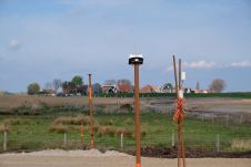
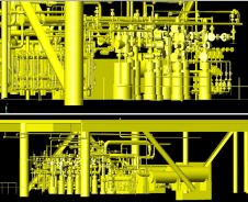
The Locator One solution for autonomous GNSS-based precision measuring has been sold and leased to numerous construction and infrastructure companies, both in the Netherlands and internationally. It w...
This site uses cookies. By continuing to use this website, you agree to our Cookies Policy. Agree